Friday, September 27, 2013
Friday, September 13, 2013
09-05-13 Together at the End
Nerves woke me up early. The last weather forecast we had received was 40% chance of showers. I lay in my sleeping bag praying it would hold off at least until we reached the top.
We started our last 5 miles at 6:20 a.m. with all our stuff in tow. Only 4,172 more feet of climbing to do until the end.
The first mile was easy, the second not so bad. A few boulders to hoist ourselves over. More boulders. Before we knew it we were above tree line, in the wind, and the bouldering became more difficult. The rebar sections were intimidating at first, with the wind whipping, but not impossible. A slow mile, but rewarding.
We crested the false summit to "The Tableland" and enjoyed the final 1.5 miles to the summit. As we got close to the top we could see the final summit sign. The moment we had dreamed about for so long was now within reach.
And then we were finished.
We rejoiced in the spectacular view. Throughout our morning climb, the clouds had been clearing out. No rain, only sun. Glorious sun.
As we looked back at the 100-mile wilderness, back at White Cap and beyond, we smiled as we remembered the past 170 days.
From rainstorms to sunshine, arguments to agreements--there we were on the top of the world. Celebrating not only the end of our long journey, but also our anniversary, ready for the next adventure.
Always together, somewhere.

Thursday, September 12, 2013
09-04-13 Somewhere at the base of Katahdin
An easy 10-mile day to the base of Katahdin. After a small "convenience store" breakfast at Abol Bridge Campstore, we set off with our whole troop of friends--Bamboo, Shaman, Morning Kid and Mash.
Into the Baxter State Park Boundary we went for some of the nicest and most graded trail we've had. The two fords of the Lower and Upper Forks of the Nesowadnehunk Stream were tricky however. The water was thigh high, but took our time and successfully crossed without falling in.
Further on, a side trail to Big Niagara Falls beckoned us. We took a short break and explored the falls. On the way back to the trail, we ran into Mash's family, so our train of people became all the more merry.
The final miles into the Katahdin Stream Campground were a blur of bog bridges, banter and giggles.
We relaxed the rest of the day and enjoyed catching up with a few faces we hadn't seen in months--Funnybone, Restless Cowboy, Peanut.
Mash's family generously let us stay with them in their campground and fixed us burgers and s'mores. Thank you! A ranger came by in the evening and gave us our last numbers as thru-hikers. B and I will be the 314th and 315th NOBOs up Katahdin this year.

Wednesday, September 11, 2013
09-03-13 Crossing Abol Bridge Together
Our last day in the 100-mile wilderness. We took our time and enjoyed the trail.
At Rainbow Lake, we stopped for a break. As we were leaving, a sea plane landed in the lake.
Our only climb of the day was up to Rainbow Ledges. The trail and stream were one. We zigged and zagged up, but it was worth it. Our first view of Katahdin.
We stopped at Hurd Brook Lean-To for a long lunch since we have extra food. Spam, tortillas, taco rice and French fried onions. One of our better lunch combination.
The bog bridges signified half a mile to go, and before we knew it we were spit out onto Golden Road--a logging road named this because it cost so much to build.
We crossed Abol Bridge over the Penobscot River and saw another magnificent view of Katahdin. A thunderstorm was approaching which made the scene more enchanting.
We waited out the storm in the Abol Bridge Campstore. As the rain let up we ventured across the street to the Abol Pines Campground for the night.

Tuesday, September 10, 2013
09-02-13 Somewhere near Rainbow Brook
Woke up early and were packed up and moving before the rain. The trail today was fast and we completed 12 miles by 12 o'clock to the Cooper Brook Falls Lean-To.
The shelter was timed perfectly. We were able to stop out of the rain and have lunch. It was hard restarting though; venturing back out in the pouring rain.
The trail was very pretty. It meandered through the pine trees next to several lakes and rivers. Several points on the trail offered views to Katahdin. Unfortunately, the mist billowed up, and we were unable to see her yet again. It makes the mountain all the more mysterious.
We pushed hard the last two miles with the hope of sleeping out of the rain. We ended the day with 20 miles--our second highest mileage day of the trip--and snatched up the last two spots in the Rainbow Brook Lean-To.
In the shelter, we were joined by Bamboo, Morning Kid, Mash and Keystone. We enjoyed mash potatoes with bacon bits and French fried onions, tucked away from the rain.

Monday, September 9, 2013
09-01-13 Somewhere near Jo-Mary Lake
The terrain flattened out nicely as we made excellent mileage and time today. We had a small 400 foot climb over Little Boardman Mountain while the rest of the day was a gradual walk down.
We stopped for a snack at Crawford Pond and lunch at Jo-Mary Road. While we ate the crew assembled back together. B's stomach ailment was a hot topic and resulted in a cell phone call to Mash's dad and uncle (both doctors). Nothing conclusive was decided. Only B was having problems and the 100-mile wilderness is a horrible place to have problems.
Regardless we kept moving north and settled in for the night on a beach at Jo-Mary Lake. Watched the sunset then turned in for an early night.

Sunday, September 8, 2013
08-31-13 Up on White Cap Together
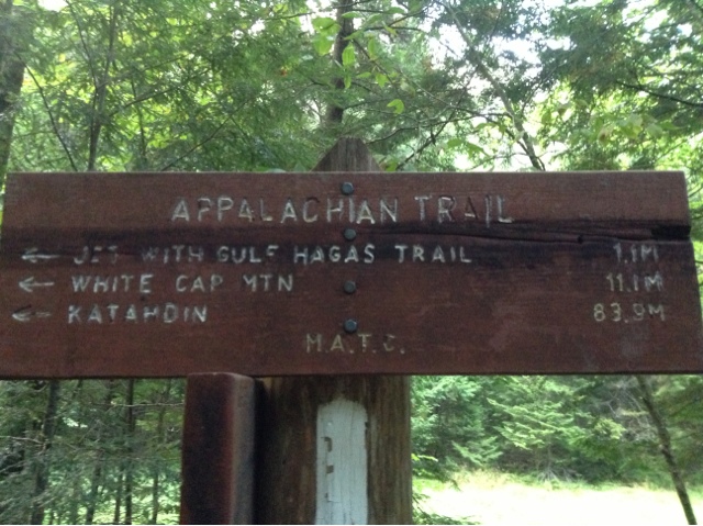
Today the terrain was amazing. Enjoyable even. We climbed Gulf Hagas, West, Hay and White Cap Mountains.
Up on White Cap we were unable to see out, but a little farther down, we were under the clouds and got a view. Still not clear enough to see Katahdin. We will just have to anxiously await her entrance.
We started and ended the day with rain. Thankfully not when we were hiking, nor when we were setting up or tearing down the tent. This rain I can handle.
Poor B has come down with some unknown stomach ailment. He has had to stop every few hours to unload his frustrations. Luckily, Check-6, a section hiker, had Imodium for B to take. He's hoping after the generous dosage he took, he'll be plugged up for the remainder of the 100-mile wilderness.
We set up camp with our friends at East Branch Lean-To. Dined on teriyaki rice with chicken and called it an early night.

Saturday, September 7, 2013
08-30-13 Somewhere near the Chairbacks
Today marked our second day in the 100-wilderness, and it was hard. B and I have both had our share of falls. B has a series of ugly knots on his shin; I, a couple of impressive bruises on my hip.
Every mile we had to work for. Occasionally we were rewarded with nice trail, a majestic view or a sliver of sun.
Today the trail took us over Barren, Fourth, Third, Columbus and Chairback Mountains.
The descent off Chairback was long and tedious. Our spirits were declining as quickly as the terrain. At Katahdin Ironworks Road, a gravel road, was a case of soda. The trail magic perked our spirits and made the last leg of our day's trek easier.
We forded West Branch Pleasant River and decided to camp to the north of it, even though it was a designated no-camping area with three other hikers.
A ridge runner walked up to the river to fill his jug as we sat there, drying our feet, and asked us where we were camping. He told us we couldn't camp there, but a developed campsite was nearby that wasn't in our guides.
We thanked him for the information and headed to the site for the night. Our tent was next to the river, so we listened to the subtle sound of rushing water as we fell asleep.
Friday, September 6, 2013
08-29-13 100 Miles From Katahdin Somewhere
Today's theme was water. Rain. Ponds. Waterfalls. Rivers.
It rained through the night and was still sprinkling when Rebecca from Lakeshore Inn dropped us back at the trailhead. Thankfully, the rain was short lived, and the sun poked its head out periodically throughout the day.
Today we entered the 100-mile wilderness. A sign at the entrance warned us of the rugged and remote dangers we were entering into. We plowed ahead, eager. This marks the beginning of the end.
The trail was a blur of puddles, ponds, puddles that looked like ponds, streams, rivers, streams that looked like rivers, mud, bogs, and mud that looked like, well, mud.
Little Wilson Falls was a spectacular waterfall with sheets of rock making it look very geometric and artistic.
We popped off our shoes to ford Big Wilson Stream and again at Long Pond Stream. As our feet dried off at Long Pond we quickly celebrated being 100 miles from Katahdin.
After a long and strenuous day--the terrain wasn't hard, I just think we're fatigued--we crawled into Long Pond Stream Lean-To for the night. We quickly set up the tent, fixed dinner and filtered water so we could call it an early night.

Thursday, September 5, 2013
08-28-13 Together in Monson, Maine
An easy day. Only a six-mile nero into Monson, Maine. We were in town by 9:30 a.m.
Our first order of business: my mom's mail drop at the post office. Monson is a small town; the only place to buy "groceries" is a small gas station. We knew this ahead of time, and my mom was delighted to help us out with six days of trail food.
Rice sides. Spam. Snickers. A well-rounded diet. Thanks Mom!
We had a leisurely lunch with Mash, Morning Kid and Grey Cloud at "Thymes and Seasons". The restaurant is in a community center; they cook the food in the industrial kitchen somewhere else in the building, then wheel it to the other side to serve it. Not the fastest nor most efficient setup I've ever seen (from ordering to paying took 2 hours) the experience was one-of-a-kind.
We stayed at Lakeshore Inn in the attic. The inn was a lot of fun; downstairs was a restaurant and bar; out back the lake with water toys. It rained the latter half of the day, so we reluctantly hung out in the bar. From 4 to 6 was "Happy Hour," half price drinks.
The crew--Bamboo, Morning Kid, Shaman, Mash, Grey Cloud, B and I--set up "camp" amongst two tables.
It being a small town (and a Wednesday), the bar closes when there aren't any more patrons to serve. We "closed" the bar down at 8:00 p.m., when we all left to go to bed.

Tuesday, September 3, 2013
08-27-13 Fording the Piscataquis Together
Started the day with a pleasant climb up Moxie Bald Mountain. Although once to the top there was no view because of the fog, we could tell that the sun was anxious to shine through.
The descent was pleasant as well. We did have to be doubly careful because some of the rock facades were slick which added an extra level of challenge.
We stopped for a quick break at Moxie Bald Mountain Lean-To. The lake in front was so inviting, it was hard to leave.
We did though and continued through a deliciously flat section. The trail led to Piscataquis River. B had no problems rock-hopping across, but I was not as lucky. With two wet shoes and four wet socks, we continued on our way.
Although the trail profile called for flat, we were up and down and up and down. Finally it tamed down, and we made good time to Piscataquis River crossing (again). I was taking any chance this time. With bare feet and sandals I forded the stream while B rock-hopped across.
We continued a few more miles and set up camp in a nondescript location amongst the pines; pine needles make excellent sleeping pads.
Enjoyed dinner and Rob and Jessica's chocolate chip cookies. With full bellies we called it an early night.

Monday, September 2, 2013
08-26-13 Together with Barbie's Leg
The sound of light rain woke us up early. We decided to sleep-in and broke camp when the drizzle lightened.
A shuttle took us to the Caratunk, Maine post office where a package from Rob and Jessica awaited us. Inside was all sorts of goodies: chocolate chip cookies, trail mix, chocolate peanut butter. Also include was a small trinket; a Barbie doll leg with "Good luck on your last leg written." We both got a long laugh out of it. Thanks Rob and Jessica for your generosity and your humor!
Back on the trail we climbed Pleasant Pond Mountain with Morning Kid and Mash. The climb kind of snuck up on us and the four mile descent was long and drawn out. The rocks were slick from the morning rain, but luckily no major falls, just a few "dance moves" as Mash refers to our slippery shuffles.
Once to the bottom we knew it was just a three mile push to Bald Mountain Brook Lean-To. Rock hopped over Baker Stream then an easy grade to the shelter.
Tonight we are camped with the usual suspects, along with a spunky retired English teacher, Slow and Steady.

Sunday, September 1, 2013
08-25-13 Lost in the dark somewhere
B here, finally got to write a day's entry after a long time off.
The shelter was a good decision allowing us to get an early start. The trail was easy; after breaking at East Carry Pond Beach midmorning, we still clocked 10 miles to the Pierce Pond Lean-to by lunchtime.
We relaxed pond-side, watching a loon fish on the lake fit for a postcard. There was no need to rush; the ferry didn't resume again until 2:00 p.m. at the Kennebac River.
The ferry has operated since the beginning of the AT and is the only ferry service on the trail. The Kennebac crossing is downstream of a hydroelectric dam; the water releases are unpredictable and cause the water to rise over 15 inches within a minute. While we were there, we witnessed how fast the water moves after a release. Many hikers have risked fording and have gotten into serious trouble on this otherwise tame looking river.
Our canoe ferry made it safely across and we ventured to the Northern Outdoors Resort in Caratunk, Maine for tasty burgers and micro brews as an afternoon snack.
K stayed at the lodge while I set up the tent across the street in the campground. I returned for happy hour and air conditioning.
It was getting late, so K left for the tent while I stayed at the lodge. After what I thought were excellent directions to the tent, she was on her way. What neither of realized, though, was how dark it would be. Not only was the campground poorly signed, but it was pitch dark too.
When I got back to the tent, I noticed K wasn't anywhere around. Morning Kid checked the lady's restroom and confirmed K wasn't there.
At this point I realized I was now on the hunt for a lost and highly-likely angry K somewhere. After a few rounds of the campground, I checked the lodge. Still no K.
It had been an hour since the last K sighting, and our friends were ready to help. Our plan included I and 5 other thru-hikers combing the campsite. Another 30 minutes. Still no K.
A vacationer drove me around the major roads as our friends began round two. My driver also happened to be a police officer so while we calmly looked for her, I got to answer all the standard police questions.
"Did you two get into a fight?"
"Not since we got separate trail mixes"
More cop questions: "Could she have run away?" and "Does she have any medical condition?"
The driver dropped me at the lodge; I was now really worried. Our next plan was to search the empty camp cabins. As I was running to my search area, MASH informed me that he had found K in a cabin tent farther down.
After she had walked down to the campground and some indeterminate distance, she realized that she didn't know where or how far she was going in the dark. She then stopped at a cabin tent and waited for me to come by.
Thankfully the story ended well, and is now just another side-adventure of our Appalachian Trail journey.

Saturday, August 31, 2013
08-24-13 Swimming Together in Flagstaff Lake
At 4:30 a.m. I asked the little face peaking out of the sleeping bag if he wanted to get up and hike to the top of Mount Avery for the sunrise.
The little face answered with a shivering "no". Relieved, I snuggled back in to my sleeping bag for a few more hours.
Once we finally did get moving, Mount Avery was beautiful in the early morning.
We hiked with Morning Kid and Mash over Little Bigelow Mountain, and joked with a groups of college kids from Tufts about hiking naked (rumor is they used to hike naked). They were clothed. And we were clothed. So there's nothing more to report on that.
At Little Bigelow Lean-To we stopped for lunch, then pushed onto Flagstaff Lake for swimming. The water was cold, but we all took a quick dip then spread out on the warm beach.
Only five more miles to camp at West Carry Pond Lean-To. The bug population was non-existent so we decided to lay our pads out and sleep in the shelter. We enjoyed our rehydrated mashed potato dinner overlooking the lake.

Friday, August 30, 2013
08-23-13 Somewhere in the Bigelows
The ran broke through the night. Although it was hard putting our wet clothes back on, the sunshine shone through and brightened our day.
We hitched into Stratton, Maine and stopped at the post office. B and I both got new shoes (mine were a one-time complimentary replacement from Merrell) and an awesome mail magic box from the Kanes. We dug through all the goodies--dried fruit, beef jerky, tortillas--and devoured Cheri and Madelyn's signature cake pops. Thank you!
Back on the trail with Morning Kid and Mash we breezed passed the 2,000 mile mark and laughed and joked our way up the Bigelow Mountain Range.
The view was spectacular from Bigelow Mountain West Peak. It was late afternoon, and the temps started dropping so we ducked back under tree line for the night at Avery Memorial Campsite.
We smushed both ours and Mash's tent onto a platform; Morning Kid and Grey Cloud were nearby where we headed over to for dinner. Grey Cloud had packed up a six-pack of brewskis which he generously offered and we graciously accepted.
As the sun set in the west, we huddled in for a cold cold night.

Thursday, August 29, 2013
08-22-13 Somewhere north of the Crockers
Started the day with a pleasant uphill to Lone Mountain. Spaulding Mountain was a similar experience.
On the way down, a plaque signified the completion of the Maine trail, the final section of the Appalachian Trail. I joked that the trail workers must have been ready to be done since this part of the trail by-passes the summits of Mount Abraham, Spaulding and Sugarloaf Mountains. I'm not complaining though; my knees were thrilled.
We rock-crossed South Branch Carrabassett River--praise The Lord, we haven't had to ford anything yet--and shot back up the Crockers.
South Crocker was sneaky. Steep. Rocky. Tiring. North Crocker was more forgiving. The day, however, was dampened (literally) when the evening showers came earlier than anticipated.
We had begun our descent of North Crocker when the thunder gave out its ominous warning. We pushed down the mountain, but not quick enough. Thoroughly soaked and miserable, we set up the tent at the first flat spot we came too. Safe and cozy, we never emerged again that night.

Wednesday, August 28, 2013
08-21-13 Somewhere 90% Complete
We've completed 90% of the trail. 1,966.5 miles. An A-minus.
Today the trail took us over the Saddlebacks. The main Saddleback Mountain, The Horn and Saddleback Junior. Much of it was above tree line, offering breath-taking 360-views.
The whole crew was together, and mighty relaxed. We stopped at each summit and shot the breeze for awhile.
Topped off our water at Poplar Ridge Lean-To, then pushed on to a woods road just passed Orbeton Stream. We setup our tent on the gravel road with the rest of the crew and enjoyed marshmallows and ridiculous stories around a tiny fire until hiker midnight (8:00 p.m.).

Tuesday, August 27, 2013
08-20-13 Together in Rangely, Maine
Pizza. Ice cream. Jurassic Park. Just what a vacation day ought to have.
Started the day with laundry; well, after sleeping in of course. We mixed six people's dirty clothes together in the load. Some of those other fellow's clothes stank. I mean bad. I kind of didn't want to mingle my clothes with theirs as I was worried that my clothes would come out smelling worse than they went in. A whole new blend of funkiness. They didn't stink though. Thank goodness.
Bordering Rangely, Maine is a glacier lake. We ate our grocery store sandwiches, grapes and Oreos at a nearby picnic table and enjoyed the activities of the lake. Ducks. Boats. Even a seaplane took off from it.
The rest of the afternoon we relaxed with the crew. For dinner we shared a pizza, but not the ice cream. We each got our own Heath bar flurry from a local ice cream hut.
To finish the night off right, we all watched the 1993 smash "Jurassic Park" at the local theater. The magic was lost, just briefly, as we realized they were playing it from a DVD. Still a hit 20 years later, 90s clothes and all.

Monday, August 26, 2013
08-19-13 Canoeing Together
Today was a day of fast hiking. Aside from roots, rocks and the occasional mud, the trail eased out nicely.
I began the day hiking with Morning Kid. We arrived at the Sabbath Day Lean-To and beach in the morning, way ahead of schedule. It was too cold to swim, but still a welcome break.
The five miles, I hiked a good portion with Mash to the next stop: Swift River Pond Campsite. We arrived around lunchtime and took a nice long break, because stashed in the trees were canoes!
I was so excited to canoe. B and I took a spin around the lake where I realized I was more excited about the 'idea' of canoeing. I was more worried about flipping and the wobbly sensation of floating in the water. B was a natural; in fact, he told me it was probably best I didn't paddle. I agreed. This is one sport I don't think is for me.
By this time it was two in the afternoon; we had planned to get here in the evening to camp. Only five more miles to town.
That was it. Shoes were back on and we were headed to town. We arrived at the road at 4:15 and got a ride from Thelma into Rangely, Maine.
Had Thai for dinner. Then a pizza for second dinner. I didn't even feel full. At this stretch of the trail we are all experiencing an insatiable hunger.

Sunday, August 25, 2013
08-18-13 Somewhere near Old Blue Mountain
Started the day with granola cereal with dehydrated strawberries and dehydrated milk to fuel us for the plummet into Sawyer Notch, then a climb back up to Moody Mountain.
The climbs, descents and terrain in Maine aren't hard, just slow going with roots and rocks. By the end of the day we were tired from all the elevation change.
We climbed up to Old Blue Mountain for lunch and bumped into two section hikers, Hop-along and Fern Lover. Two hilarious old ladies. Slow moving, but loving every minute.
It was sad to depart with them, but Katahdin beckons. We climbed Bemis Mountain then descended into Bemis Mountain Lean-To for the night. I passed a family of grouse (plural grice?), but unfortunately didn't have the camera.
Enjoyed dinner with friends, then Bamboo, Shaman and Mash scooted on ahead to night hike.

Saturday, August 24, 2013
08-17-13 Somewhere near Andover, Maine
Hiked into Andover, Maine early and shuttled into town with Mash. The gang was already in town, and Bamboo had zucchini bread and cookies--yum!
We bought a small resupply, because the general store was a bit pricey. B also bought a pair of "glittens" which were not pricey. Then we saw a sign on a bulletin board about a lobster dinner that night at the local rotary club. We called up the club and they were delighted to have us.
Not long after we got the unfortunate news that all the lobsters the rotary had were sold. No room for us.
Instead we had lunch at a local store then hit the trail. At Surplus Pond we stopped to swim. Morning Kid, Shaman, Bamboo and Mash were already in as B and I staggered into the rocky pond.
About five minutes passed when Shaman discovered he had a leech on his knee. That was it. We all rushed out; not before I banged my knee on a rock though.
We gradually climbed Wyman Mountain then descended into Hall Mountain Lean-To for the night. Mash started a fire, which I horned my way into and we enjoyed the rest of the evening shooting the breeze and eating Ramen (the cheapest thing at the general store).

Friday, August 23, 2013
08-16-13 Up on Baldpate Together
Tackled Mahoosuc Arm early in the morning. With fresh legs it was enjoyable. A few boulder obstacles. Slab rock climbs.
Once to the top, it was a small descent into Speck Pond. A challenging climbed up to Old Speck, then an easy 3.5 plummet into Grafton Notch.
We stopped at a picnic table with Tugboat and Chickadee for lunch. A weekended asked us if we would like bread and jam. We hungrily accepted and gobbled up an entire loaf of bread and jar of raspberry jam.
Back on the trail it we climbed up to Baldpate west peak. Baldpate east peak was a bit more challenging as we were walking up shear rock faces to the top. The terrain leveled out and we could see 360-degree views of what we'd already traversed, and what still lay ahead.
Finally, a steep descent into Frye Notch Lean-To for the night. We are joined by Morning Kid, Shaman, Mash, Grey Cloud, Peaches, Fire Hands and Lucy (a pup).
Enjoyed macaroni and cheese around the campfire and throwing in birch bark to really make the fire roar.

Thursday, August 22, 2013
08-15-13 Together in Maine
Successfully climbed Mount Success first thing in the morning. Our next success: crossing the New Hampshire / Maine border. Our fourteenth and final state. 282 miles to go. I don't think it has really hit us yet.
Up and over Mount Carlo we went, then Goose Eye West and Goose Eye East. We stopped at the top with Morning Kid and Mash for lunch. The wind and cool temps cut it short, and we were up and over Goose Eye North in no time. I take that back. The terrain in Maine is still a little slow going.
We stopped at Full Goose Shelter to prepare mentally for what came next: Mahoosuc Notch. A jumbled pit of boulders billed as the "most difficult or fun mile of the Appalachian Trail."
It was fun alright. And difficult. Up. Down. Over. Under. We took our packs off twice to squeeze through two rocks; then again to squeeze under. After two hours of this madness, my upper body strength was shot.
I slumped into the campsite, strategically located right after the notch, and barely moved. We weren't the only worn out souls. A whole slew of NOBOs joined us: Bamboo, Shaman, Morning Kid, Mash, Grey Cloud, Peaches, Fire Hands (and Lucy the pup), Tugboat and Chickadee.

Wednesday, August 21, 2013
08-14-13 Somewhere near Gentian Pond
Had a scrumptious breakfast burrito to jump start our day then headed back out onto the trail.
Now that we are out of the Whites, the trail has tamed. We hiked up Mount Hayes then up Cascade Mountain. The rocks and mud were a bit slippery, but we were so thankful for easier terrain.
We were treated to a couple of picturesque ponds today, Page Pond and Dream Lake. We've heard that we will be seeing more of these untouched, wilderness ponds in Maine.
We had lunch with a view at Wocket Ledge, then stopped for the night at Gentian Pond Shelter. The wind and cool temps kept us from swimming but we still enjoyed its beauty.

Tuesday, August 20, 2013
08-13-13 In Gorham, New Hampshire Together
The rain pattered on the roof as we looked at each other this morning and decided to zero. A rest day to celebrate finishing the Whites. Or rather to recuperate from the Whites. Either way, my mind and body was ecstatic.
We stayed at White Mountains Lodge and Hostel again. The owner, Marni, purchased the property two weeks prior and is joined by her mom, Molly and son, Sam. This might be our favorite hostel. It is well maintained and Marni and her mom are so hospitable. I almost felt like I was part of her family. Plus the location is perfect--right on the trail.
Once we decided to zero, our entire day and our demeanor relaxed. Molly shuttled us into town to resupply, then dropped us off at the coffee shop where we plugged into the free wifi.
We caught a ride back to the hostel, and enjoyed the rest of the day resting and catching up on trail gossip. Old friend Nova was there and we met a few new faces.
Had chili and ice cream for dinner and watched the trail movie "The Way" with a room full of hikers. Back in March before leaving for the Appalachian Trail we watched it, but with the second time around, the movie had a different meaning for us.

Monday, August 19, 2013
08-12-13 Saying "good-bye" to the Whites Together
Slept in so we would hit Carter Notch Hut after breakfast for free left-overs. It worked, and we nibbled on blueberry muffin bars before climbing back up to Carter Dome.
The trail was amazing and we stopped for lunch on Middle Carter Mountain with a view. Once up and over North Carter the trail plummeted down to Imp Campsite, and plummet it did right along with my heart.
Back up to Mount Moriah then a steady down to Gorham, New Hampshire. The trail eased out and we made it to the outskirts of town. Right off the trail we stopped for the night at White Mountains Lodge and Hostel.
Showered, sheltered, and seated on a couch with a delivered pizza, we almost felt like real people again. Had a nice private room upstairs, albeit, I Love Lucy style, and slept soundly knowing the Whites, in all their glory and difficulty, are behind us.

Sunday, August 18, 2013
08-11-13 Somewhere on Wildcat Mountain
The agreement for staying at Madison Spring Hut was that we had to be gone by 7:00 a.m. The SOBOs weren't moving to fast, but we had no problems getting out the door in time.
Our climb up Mount Madison for exhausting. Gusts of 50 mph with every step. I clung on, dreading to go higher. Once we reached as far up as I could see, we'd turn the corner to see Madison stretching up higher. Finally we were at the top. Now we had to go down with the same gusts.
I longed for tree line. Closer and closer it came, but not before the wind sucked all the life out of me.
The trail went through the "Great Gulf Wilderness" a section where they removed all the blazes, signs and foot bridges so hikers can have a "total wilderness experience". I've never heard such malarkey; if you want a total wilderness experience, go bushwhack. Thankfully, we had no problems navigating through it; all the day-hikers kind of killed our wilderness experience through it though.
The trail evened out and we made it to Pinkham Notch and the visitor center. I was totally wiped. My brother and sister-in-law sent us a care package of baked goods and we dug through it like kids at Christmas. Thank you Matt and Steph!
The goodies helped restore our energy and we began our climb up to the Wildcats (no, the range was not named after Willie the Wildcat). A gnarly climb, but with good weather and no wind, we had no problems getting up.
Tired, we stopped short of our goal. We found a stealth spot with a view on Wildcat Mountain Peak A. Ate dinner then slept like babies through the night.

Saturday, August 17, 2013
08-10-13 Up on Mount Washington Together
Had a hearty breakfast of all-you-can-eat cinnamon rolls then were off and rolling. The weather didn't look promising at first--fog everywhere, limited visibility--but once we had cleared the tree line, it was as if God lifted a veil and all the views were visible to us.
We hiked along the exposed ridge, passed Pierce, Eisenhower, Monroe, to Lake of the Clouds Hut. Walking through 50-60 mph winds had worked up an appetite, so we gobbled up all of Lake of the Clouds' cookie bars then made our way up an unforgiving and windy Mount Washington.
Our planning worked out perfect and we got a clear view from the summit, and highest point in New Hampshire (elev 6,288 feet).
Mount Washington was a zoo--cars, people, a train, people, buildings, people. To get out of the wind to eat lunch we went inside to find it overflowing with people.
We began a windy ascent down, passed Clay, Jefferson and Adams. At Madison Hut we were exhausted and stopped for the day, hoping to get a work-for-stay, but nine other thru-hikers were already there (all SOBOs). We never heard anything definite, so we just sat there playing the waiting game.
By nightfall, there was nothing the hut crew could do to us, so they let all of the thru-hikers stay (no food) on the floor in the dining area. We were ecstatic--the last thing we wanted to do was have to hike another 3 miles in 50 mph winds.
We hunkered down in our sleeping bags and enjoyed a long night's sleep safely away from the wind.

Friday, August 16, 2013
08-09-13 Somewhere near Webster Cliffs
Thunderstorms rolled through the night and we woke up to the sound of rain. The forecast called for all-day rain, and the Doppler backed it up.
We spun our fingers for awhile then decided to pull the trigger. Doc drove us back to the trailhead. I had hoped the rain would have lightened up by then, but it hadn't. Luckily we were only hiking 6.4 miles to Mizpah Hut for the night.
The climb wasn't bad, although some sections were technical and required us to lift our bodies up and over. Up on Webster Cliffs, looking down on the valley it was actually quite enchanting. Eerie, but enchanting. The fog billowed up slowly like we were in a witch's cauldron.
Mount Webster and Mount Jackson offered similar views. Slightly exposed, neither are above tree line.
At Mount Jackson we met Heron, a Mizpah Hut crew member. She offered us cornbread, which we graciously accepted. Although in getting to the cornbread, B slipped down a rock face, then I fell and slid down it.
The remaining 1.7 miles of trail was either underwater or a waterfall.
We arrived at Mizpah Hut (Mizpah means "pillar in the woods") a little after 4:15 p.m. Heron had already told the other crew members about us, so we had spots #3 and #4 for the work-for-stay. Old buddy, Lush and another hiker, DC had made it in a little earlier.

Thursday, August 15, 2013
08-08-13 Together in North Conway
It started raining around 1:30 a.m. and again at 4:30 a.m. When we began stirring around seven it was still sprinkling. Good. It is always heartbreaking to make plans around the weathermen, and then the forecast turns out incorrect.
Doc drove us to the bus stop to drop off Cliff Note. We met Cliff Note in Vermont, a real nice college kid from North Carolina (we won't hold his UNC ties against him). Nicknamed a "mayfly" because he started in early May, he flew by us because he wanted to finish before the school year started. Not long after, he realized he had to hike high 20s through some of the hardest but most beautiful sections of the trail. Instead, he opted to spend the remaining time on the trail enjoying the scenery, culture and people. Although it was sad to see this part of his journey come to a close, we wish him the best of luck.
The sun started shining around noon, but the clouds remained and clung tightly to the mountains. I'll just assume that it was absolutely miserable and windy and rainy up there. It helps us justify taking a zero.
Our legs are antsy. We're ready to hike, but we have to be safe. To ease our wandering spirits, we walked around town and caught a movie, Despicably Me 2. We also killed some time at Books-a-million reading about new adventures.
We fired up some hiker food for dinner and settled in for the incoming thunderstorm.

Wednesday, August 14, 2013
08-07-13 Somewhere near Crawford Notch
We slept under a table in the dining room and got up and packed before the guests. We hung around until after the guests were fed, then ate all the leftover pancakes and pineapple. To finish off our work-for-stay, we swept the floors in the dining and bunk rooms.
We began the eight mile stretch to Crawford Notch with Cliff Note. The trail was uncharacteristic of the Whites--graded, smooth, easy. We flew.
We reached the notch around noon. The next section is the Presidential section of the White Mountains, 20 miles of ridge line walk all exposed and above tree line. The forecast called for evening showers, and thunderstorms all day Thursday.
Mount Washington is not the place to be in a storm. It is famous for its "dangerously erratic weather" and until 2010, held the highest wind gust record at 231 mph. Yes, I typed that correctly, 231 mph! Over 137 deaths have occurred on the summit due to the weather.
We called an audible and decided to let the weather roll through before tackling the Presidentials. A hard decision, especially since it was still beautiful out. Cliff Note joined us, and the three of us caught a ride into North Conway, New Hampshire.
Typical Americans, we crashed at McDonalds for cheap food, air conditioning and a place to recharge our electronics.
We walked over to Doc and Llama's house for the night. They are former thru-hikers of the Appalachian and Pacific Crest Trails. After sweeping out the garage, we setup on a few cots in the garage. They generously allowed us to shower and launder our clothes.

Tuesday, August 13, 2013
08-06-13 Somewhere near Zealand Falls
Woke up early and tackled Mount Garfield before the sun rose above the ridge. Although rocky at times, the trail was kind to us today.
Stopped for lunch atop South Twin Mountain with majestic 360-degree views. I also got a halfway decent signal to call Merrell's customer service number. My new shoes are separating. Fortunately, Merrell has a one-time replacement for thru-hikers.
We continued along the Zeacliff Ridge, then dropped down to the Zeacliff Falls Hut. We actually got to the side trail at 3:30 p.m. but lingered for thirty minutes before approaching the hut.
At tinge after four, we went into the hut and talked to "Kroo" member Kayla about a work-for-stay. She was happy to have us, and after washing dishes for 45 minutes, we had an awesome (leftover) dinner of lasagna, soup and chocolate sour dough cake. We are joined by NOBO buddy Cliff Note, and SOBO Chicory.

Monday, August 12, 2013
08-05-13 Along the Franconia Ridge Together
After a 5:15 a.m. wake-up alarm of a SOBO hiker throwing up, we resupplied and were headed back to the trail.
It was a hardy climb up to Franconia Ridge, but very very rewarding. Up above tree line, we reached Little Haystack first. Without the protection of the trees, it was extremely windy. We ducked behind a few boulders for lunch.
The trail continued along the open ridge line to Mount Lincoln and Mount Lafayette each with magnificent views. We had to keep our center of gravity low, though, because of the sudden wind gusts.
The trail back down to the tree line was tricky, but once concealed amongst the trees, we were relieved to have a break from the wind.
We set up our stealth camp at an old shelter site in the 30s. Although nothing remains except a clearing, it was fun to feel somewhat connected to the past.

Sunday, August 11, 2013
08-04-13 Somewhere in the Kinsmans
I'll start by saying today was a very low day for me. The Whites are breaking me down, but I'll try to put a positive spin on things.
We slept in an hour then proceeded down the trail to see that we hadn't reached Gordon Pond the evening before. Further north we hiked up Mount Mist to see a panoramic view of fog--no surprise.
For those who complain about the mud in "Vermud," they have obviously never been to New Hampshire. We came to one of many pools of mud and I leapt for a bog bridge half submerged in the mud only to land on my rear end, the left leg engulfed in mud up to my knee. Pulling my leg out was the easy part. Pulling my leg out, but keeping the shoe on was tricky. I struggled and twisted, ranted and raved, but finally pulled out a muddy leg and a muddy shoe.
Next up was Kinsman Mountain. I have nothing remotely positive to say about this. Hard technical climbs. Hard technical descents. Cold. Windy. Rainy. Chuppacabra caught up to us and brightened the mood, but it was short-lived. Hours and hours of bouldering and slick sheets of rock broke me down mentally.
We made it to Lonesome Lake around four, but decided to push into Lincoln, New Hampshire for the night.
OB and Danno ascertained a vehicle and drove back to the trailhead to pick us up. We ended the night at Chet's Place, a former thru-hiker who opened up his garage to other thru-hikers.
A neighbor was hosting a garden party to benefit the local theatre and invited all the thru-hikers. The party was amazing; open bar, buffet, homemade ice cream, local entertainment, all provided to us for free. At $75 a head, we were extremely grateful for the generosity--well most of us.
We had already returned to Chet's Place when a SOBO hiker punched and knocked out a yellow-blazer at the party. The police showed up at 11:00 p.m. to Chet's Place looking for them and searched the garage and the backyard. A policeman shined his flashlight into our tent, which we then opened to show we weren't harboring anyone.
That finally died down. Long story short, the SOBO jumped the fence and ran off.
Then at midnight a hiker started screaming outside at the top of his lungs. Chet never could locate him, but the next morning we could tell that several tents were gone and a lot of the SOBOs had gotten kicked out.
Never a dull day on the Appalachian Trail.

Saturday, August 10, 2013
08-03-13 Together on Mount Moosilauke
Slept in and had a hearty breakfast of eggs, bacon and blueberry pancakes. It may seem like we are slacking off now--sleeping in, eating town food--but it was all part of our plan.
The plan was actually to wait for the a.m. showers to pass through before conquering Mount Moosilauke.
At 8:00 a.m. we ventured out and up. Within five minutes on the trail my shoes, socks, gloves and rear end were wet. Oliverian Brook was not kind to me.
This fueled my motivation up the climb, that and not wanting a group of slack-packers to catch me. We summited around 11 a.m. in the wind and the fog. I'm starting to think that's what Katahdin is going to be like for us.
Mount Moosilauke stands 4,802 feet in the air, the summit exposed and up above tree line.
Luckily the clouds rolled in and out so we had a gorgeous view. But with the cloud rolling came the wind and the wind chill so we moseyed back down to tree line.
The descent was slow and rocky. We stopped after 2.3 miles at Beaver Brook Shelter for lunch. The remaining 1.3 miles down to the north base of the mountain were cruel and unusual. We made it safe and sound; my heart skipped a few beats on a few rock slides though.
At the bottom, strategically placed were two gals, one a former thru-hiker named Lady Pants, with trail magic. A welcome sight after a long and brutal hike. Thank you!
As I shoveled hummus into my mouth B reminded me we still had a few more miles to go. Up the trail we had planned to camp on a side trail to Gordon Pond.
Fast-forward several hours later as we continued begrudgingly forward anxiously awaiting the side trail. We finally gave up and plopped down next to the trail. At this point we're not sure if we missed it and are way ahead or if it's still ahead. Only time will tell.

Friday, August 9, 2013
08-02-13 Hikers Welcome Somewhere
This morning we slept in until 6:45 a.m. as we had a light day both in miles (11.5) and terrain.
Aside from water dripping off the trees, breaking down camp was a breeze as the rain had let up in the night.
It was a nice and easy day, and we took it nice and easy. Only a couple minor climbs--Ore Hill and Mount Mist--and road crossings.
At NH 25C, we met up with Sweet Tooth, wife of Molar Man. The last time we saw here was on the Blue Ridge Parkway, many moons ago. She supports her husband's thru-hike, and while she waits for him, offers other hikers sodas and sweets. It is always a joy to see her white vehicle at a crossing.
At NH 25, we hiked east down the road to the "Hikers Welcome Hiker Hostel." Laundry, shower and a bed for the night; can't beat that. B and I are both smushed onto a twin bunk. We are used to it though, as our tent isn't much wider.
The caretaker took us to the "Green House Restaurant." On the menu is an eight pound pizza called the "Moosilauke Monster." If two people eat it within an hour-and-a-half it is free; otherwise, it's $32.00. If you puke inside, it's double. Chuppacabra and Rail Splitter tried their luck but succumbed to the hamburger, bacon, tomato, olive, cheesy, etc heaping mess that it was.

Thursday, August 8, 2013
08-01-13 Up on Smarts Mountain Together
Enjoyed a leisurely morning on Bill Ackerly's back porch with NOBOs and SOBOs alike. Shoved off a little after 7:30 a.m.
Vermont was fun, fast and friendly. New Hampshire, however, is posing new challenges. Our first of the day: Smarts Mountain. The climb was a tad shy of four miles, and the last two miles I slogged along at a one mile an hour pace. Frustrating.
B waited for me at the top and had the tent drying from the dew the night before. We climbed the fire tower cautiously, as the wind was whipping making it seem more dangerous than it really was. Once to the top was had 360-degree views--and no fog!
We began the four mile descent down the ridge line which turned out to be quite pleasant. Once we hit the gravel road, it was back up.
At Eastman Ledges, we ate a chicken, tomato sauce and tortilla lunch. We could see the darker clouds rolling in.
We continued climbing and crested Mount Cube with glorious views. I wish we could have spent more time on it, but we could tell something was brewing.
Safely down the ridge we stopped for the night at Brackett Brook minutes before the rain began thundering down. Dinner was a huge chore, boiling water out in the rain in our ponchos. We ate standing up and were happy to return to the tent once it was done.
The rain let up around 8:00 p.m. right as we were drifting off to sleep.

Wednesday, August 7, 2013
07-31-13 Together with the "Ice Cream Man"
A nice first day of hiking in New Hampshire. After climbing to the top of Moose Mountain, we stopped and caught up with old friend, OB (Old and Busted).
We pushed on another mile to Moose Mountain Shelter and stopped for lunch with OB, Pippen and Steady State.
We hiked down the mountain the back up to Holts Ledge for nice views. A short two mile plummet to Dorchester Road. Once across, we followed a short side trail to Bill Ackerly's house for ice cream, camping and croquet.

Tuesday, August 6, 2013
07-30-13 In Hanover, New Hampshire Together
Grey Beard and Short and Sweet talked highly of the town general store "Dan and Whit's" so we decided to give it a try. Yes, we were impressed. A maze of anything and everything. Food. Lawn and garden. Nuts and bolts. Clothing. And on and on.
Their motto: "If we don't have it, you don't need it."
We left the store with postcards, breakfast sandwiches, screws and free day-old wraps. A very successful visit.
We rode the bus to the Dartmouth Campus and setup HQ at the Dartmouth Outing Club building. B's mom sent us a mail drop with our winter gear and other goodies. I think we ate half the ranger cookies within thirty minutes. Thank you!
B went and saw "Wolverine" at the movie theater, and I relaxed on the front lawn of Dartmouth working on crossword puzzles.
For dinner we thought it would be a great idea to hit up the all-you-can-eat pizza buffet at "Everything But Anchovies." Fast-forward an hour later as we climbed the mile to the Velvet Rocks Shelter. Bad idea.
We're settled in now, though, with overstuffed food bags, overstuffed bellies and overheated sleeping bags. I'm not sure what this is a recipe for, but it doesn't sound pretty.

Monday, August 5, 2013
07-29-13 Sadly Leaving Vermont Together
It rained throughout the night, but stopped right as we woke up. Thanks Vermont!
Today was our last day hiking in Vermont, and out of the last twelve states, Vermont has been our favorite. The terrain. The weather. The beauty. We will miss you.
The trail first took us through West Hartford, Vermont where we picked up a mail drop from my friend, Kate. Mac and cheese, cookies, Capri-suns. Girl did good, thank you!
Back on the trail we made a late day decision to push into Hanover, New Hampshire. The thunder rumbling in the distance was good motivation too.
We rolled into the Vermont side (Norwich) a little after four and continued on across the river into New Hampshire.
We spent the night at a trail angel's house, Grey Beard and Short and Sweet. The treated us to a shower, clean clothes and dessert. Thank you so much for your hospitality and generosity.

Sunday, August 4, 2013
07-28-13 Together On The Edge
A foggy morning, from an overnight rain, made for an unmotivated me. The rain held out and the terrain leveled out quite a bit allowing us to make great time without killing our feet.
With ten miles in the belt, we stopped at On The Edge Farm for a soda and a homemade, blueberry peach pie, in addition to our normal lunch.
Full, but not too full, we made a final five mile push up a small mountain (maybe just a hill? not sure how these classifications go) with a view. Storms were expected so we hiked a bit further to be protected by the trees.
The terrain made for a fast day, so we had finished early and spent the evening relaxing and resting.

Saturday, August 3, 2013
07-27-13 Together at Maine Junction
A cool morning to finish our descent of Killington Mountain. Near the bottom we ran into old friends, Danno and OB.
At Maine Junction we said adios to the Long Trail after 100+ miles. From here the Long Trail continues to Canada. And we continue to Maine.
The trail led us through Gifford Woods State Park, where we stopped briefly for a shower. Not much further on, we got a ride into the ski town of Killington, Vermont.
We sat outside the deli and enjoyed a sub sandwich. Oreo and Quahog stopped through and graciously bestowed upon us a "Mom's House," a home-cooked dehydrated meal Quahog's mom makes for them. We were delighted to try one.
Back on the trail we relaxed at Kent Pond, then thundered by Thundering Falls, and a few confused tourists.
Before settling in for the night, we met Eleven, a thru-hiker that was the 11th hiker to start this year. We had met four day hikers in Virginia that had spoke about her and how she had an even colder and wetter start than we. It was exciting to finally put a face with the name.
With our soar feet up, and the tent ready for the night, we rehydrated our "Mom's House" meal: homemade chili. It was delicious--thanks Quahog's mom!

Friday, August 2, 2013
07-26-13 Somewhere 500 miles from Katahdin
Another cold night and sluggish start. We got our first view of the day down toward the Rutland Airport.
Today part of the trail had been re-routed back in October of 2011 due to Hurricane Irene. We could still see the damage, but the new trail was complete so we saw no need to take the detour. Even the car bridge that had been destroyed had been replaced with a make-shift bridge out of fallen trees.
The trail continued to an exciting milestone--only 500 miles to Katahdin!
Ate lunch with Chin Music at Governor Clement Shelter. Refueled, we began the climb up Killington Mountain. We stopped at the top at Cooper Lodge Shelter (elev. 3,928) The view was obstructed by clouds, and brrr the temperature had dropped.
We descended about 500 feet and stopped for the night at the trail junction to Pico Camp. There was a small cleared surface perfect for our tent. We ate dinner then bundled up for the night.

Thursday, August 1, 2013
07-25-13 Somewhere with a lost girl (no, not K)
Brrrrr! It turned out to be a cold cold night. Once the morning rolled around it was hard to motivate ourselves to leave the warmth of our sleeping bags.
We eventually did, though and had a wonderful day of hiking. The cool weather kept the mosquitoes at bay and we didn't worry about overheating.
Hiked past Little Rock Pond and up our third Bear Mountain (we hiked ones in New York and Connecticut).
On our way back down and through Patch Hollow a girl about seventeen, approached me. After consulting my guidebook, I quickly learned she was lost. I suggested she follow me to the next shelter about a mile away. She agreed.
We called her parents and the trail group she was working with and they got her headed back in the right direction.
We filled up our bottles with crystal clear water, then decided to stay the night at the Minerva Hinchey Shelter. Set up the tent and settled in for another potentially cool night.

Wednesday, July 31, 2013
07-24-13 On Baker Mountain Together
Today was a nice peaceful day. We didn't see many folks, but the terrain more than made up for it and greeted us with its beauty.
Through the fog we could see the ski runs and gondola atop Bromley Mountain. The ridge continued to Styles Peak where we stopped for lunch. Down we went to Griffith Lake then back up to the most enchanting view on Baker Peak.
A final two mile descent to Lost Pond Shelter for the night. Though mosquitoes are in the area, there aren't enough to warrant bug spray--what an amazing gift.
We are near the brook which adds an additional level of coolness to an already cool night. We will be sleeping extra snug in our sleeping bags tonight.

Tuesday, July 30, 2013
07-23-13 Together in Manchester Center, Vermont
The rain started around 2 a.m. and never let up. With only five miles into town, we decided to sleep in and let the rain pass. It never did.
B checked the Doppler on the smartphone to discover that we were a small pin in a sea of green.
Yep. Not only were we going to be hiking in the rain, but also tearing down and loading up in the rain.
We tore down the tent under the rainfly only to find out our camp spot was a huge puddle. Even though the inside portion was dry, it was only a matter of time before it would be wet in the bag. It was at that moment we decided to stay in town.
The five miles of trail were a series of streams, roots and mud puddles. Our feet were soaked in the first five minutes which actually made hiking in these conditions easier. The stream crossings became waterfall crossings. 1,000 miles ago I would have been miserable. Today I was having fun (it also helped that I knew I would be in town).
At the highway we hitched a ride with a lady and her children into town. One brand new SUV. Two smelly, wet hikers. Equals awesome trail magic--thank you!
According to a local, the main industry in Manchester Center, Vermont is tourism--golf, skiing, outlet malls. We stripped down to our ponchos and washed our clothes, then showered and had lunch with Morning Kid, her parents, Bamboo and Shaman.
Tonight we are staying at the Chalet courtesy of Morning Kid's parents. They also treated us to a special dinner. Thank you so much for your generosity!
It's amazing how one's day can change--starting it in a wet tent, ending it in a dry bed.

Monday, July 29, 2013
07-22-13 Inspired On Stratton Mountain Together
Beginning at three o'clock in the morning it began lightly raining off and on. At 6:30 when it began lightly raining again as I started my hike, I didn't think much of it and figured it would stop shortly. Wrong. For the next hour and a half it rained steadily with short fits of downpours.
The trail was flooded, and as I slouched through the puddles, it was a new sensation--ice cold water.
The rain stopped early morning, in time for us to reach the top of Stratton Mountain (elev 3,936 feet) and climb the tower for a view. One hundred years earlier, James Taylor stood in that very spot and dreamed up the Vermont Long Trail followed a few years later by Benton MacKaye's Appalachian Trail idea.
After a three mile climb back down the mountain, we were sitting on the shores of the Stratton Pond eating lunch, and drying our shoes, socks, feet, etc.
The rest of the day was fun; well, once you got over trying to be clean or dry. We saw the best of the best in Vermont mud. Slid, slipped, tripped, full on fell, splashed and sloshed; you name it, we did it.
Filtered water in preparation for dry camping near Prospect Rock. Arrived before the rain, and set up in time. Once it passed, we ate dinner looking out towards the Green Mountains and down into Manchester Center, Vermont.

Sunday, July 28, 2013
07-21-13 Somewhere near Glastenbury Mountain
The evening shower made for a cool morning. While we ate our bagel breakfast, I almost felt like we were getting ready for a bicycle ride; nostalgia dies hard. Regardless, today was excellent hiking--or biking weather.
The first 105.2 miles of the Appalachian Trail in Vermont are also the Long Trail. So far, I am loving the terrain. There's variety--mud/rock hops, steep up and downs, but my favorite is the spongy pine-needle laden trail where we can just cruise.
Enjoyed a chilly, but spectacular view from the lookout tower atop Glastenbury Mountain. Continued on to Kid Gore Shelter for lunch also with a great view.
With 12.8 miles already in the belt, we headed to Story Spring Shelter a final 4.6 miles on the day. It's refreshing to have a spring again that outputs cold, CLEAR water. Cheers!

Saturday, July 27, 2013
07-20-13 Together in Vermont
For the most part, the terrain was pleasant and we made great time. In some sections, the trail was muddy so we had to be strategic about which rocks to step on. Once, I stepped on a "false rock" and watched as my foot disappeared into a pile of mud. Surprisingly, my shoes didn't get wet.
We stopped for lunch at the Congdon Shelter with Shaman, Bamboo and Morning Kid's dad. Filtered additional water to keep hydrated. Unfortunately most of the water in this area is tinted an off color. Thankfully though, it tastes much better than the sulfur water we had several days previous.
The trail led us straight down--literally, straight down--800 feet to Vermont Highway 9. We took a brief break at the bottom to recoup and were reunited with Wolf Man and Grey Cloud. They were being dropped back onto the trail, so their buddy kindly took our trash--thank you!
Then it was straight back up 1,100 feet to our campsite at Melville Nauheim Shelter. The climb actually wasn't that bad, except I ran out of fuel. Even with the snack we had just ate, my body was starving.
Had a hearty dinner with friends while it lightly rained outside. Fell asleep to the sound of subtle raindrops on our tent.

Friday, July 26, 2013
07-19-13 At the highest peak in Massachusetts together
We resumed our ascent of Mount Greylock, the highest point in Massachusetts at 3,491 feet. At the top is a Veterans War Memorial Tower where we had our morning snack.
The signs signaling us down the summit were not only confusing, but pointed in the wrong direction. We ignored them and followed the path that actually looked like it was going down.
We followed a ridge to Mount Williams and then plummeted down the mountain into Williamstown, Massachusetts.
The trail has been leading us through all sorts of towns lately. This is indicative of why the Appalachian Trail was originally created: to give people in town an outlet into nature.
Rode a couple of trail-magic bikes to the Stop and Shop for yet another resupply and lunch. Our eyes were bigger than our stomachs, so we had to pack out some of the food we bought for lunch.
We dropped the bikes off and the homeowners let us fill up our water bottles too. It felt great riding a bike again; wind in our hair... Why are we hiking again? Oops, I digress.
The climb back up to the ridge was gradual, but tiring with the midday heat. We crossed into Vermont, our twelfth state, and set up camp shortly after the border. Slathered my burns in Neosporin again for the night. Leg is much better, but hand still feels like a really bad sunburn.

Thursday, July 25, 2013
07-18-13 Somewhere with first and second-degree burns
Now don't get too worried with the title; remember second degree burns is like a really bad sunburn with blisters.
Before we get to that story though, let's start from the beginning...
We enjoyed our last few hours of civilization in Dalton then headed back into the woods. Packed out a sub sandwich for lunch and ate it on the marble outcroppings named "The Cobbles" with a view down to the Hoosic River Valley and Mount Greylock.
Continued downhill and into the town of Cheshire, Massachusetts. From there it was a gradual uphill as we began our ascent of Mount Greylock. Stopped short of the summit at Mark Noepel Shelter where we called it a night.
For dinner, we headed over to the shelter with friends Bamboo, Shaman, Morning Kid, her dad, and Steady State.
I was in a seated position boiling water on our alcohol stove. The water reached a boil and the flame burned out. I was pouring the water into our Rice Sides' sleeves when I lost my grip and spilled it on my leg. In a frenzy I raced to set down the pot and spilled more on my hand. I rushed out of the shelter eager to get my pants off the burned skin.
B poured cool water on the burned areas and we slathered Neosporin on. I ventured back over to the shelter for dinner, but spent the remainder of the evening airing out my wounds in the tent.

Subscribe to:
Posts (Atom)